After the Presentation Day and QHS meeting, the team in Üsküdar selected the “I own my Garden” pilot for the scale-up phase. A new park was identified for the pilot scale-up, Nakkaştepe Millet Bahçesi Park, which connects multiple transportation points. Several green areas in Üsküdar are affected by mobility issues similar to those tackled by the first pilot round. The Nakkaştepe Millet Bahçesi Park has gates on either ends that are opening up to public transport stops. Therefore, the park is a significant mobility route for accessing these stops. However, the park is in a steep area that does not currently have dedicated walking routes.
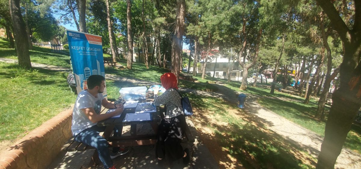
The Prototyping activities occurred live at the park on 11 October 2019 and involved pilot coordinators, citizens from previous co-creation events, stakeholders, and citizens who happened to be in the park and were interested in the project. During the previous co-creation activities, participants had developed potential ways to improve mobility inside the park and eventually, the resulting suggested concepts were:
- Testing the use of municipality-owned electric cars for elderly or disabled travelers through the park;
- Identifying and painting the walking routes that are shortest, easiest, fastest, or most enjoyable for pedestrians walking from one park gate to the other;
- Creating information boards with maps, routes, and other useful information for pedestrians who wish to use the park as a way to travel (this concept may be combined with the second one).
For the prototyping event, one of the municipality’s electric cars was taken to the park for prototyping and made available for one hour, with a driver from the municipality. During this hour, elderly people and those with disabilities were invited to use the car to cross the park. The car currently remains in this location, and will be made functional if this concept is taken up during piloting.
As a second activity, new routes on the ground were designed through a mapping activity. Participants drew a map of the park with the location of the bus stops and mapped the routes they are most likely to use, along with other spots of interest in the park. During this activity, the different priorities of citizens emerged. Some of them emphasized the shortest routes, while others emphasized the easiest.
Finally, participants were asked which information would be most useful to them, and what they would like to see on the boards. As a result, participants noted the importance of making access and routes to the public transportation stops a clear priority of the information boards.
Each of the 3 piloted ideas for scale-up must now be presented to and approved by local government officials and by experts on parks and mobility. These consultations will be based on the outputs of the prototyping events and park experts will evaluate the costs to determine whether and to what extent a larger rollout of these ideas is feasible.
Stay tuned for all updates!

















 English
 Magyar
 Ελληνικά
 Deutsch